Breeding bird surveys
A couple of Fridays ago, James and I took off with our tent and birding gear and headed south to Mercer and McDowell Counties in the southernmost part of WV to conduct two breeding bird surveys. The BBS is a monitoring program designed to track the status and trends of North American birds, and has been happening all across the United States with the help of thousands of dedicated volunteers and hours of work since 1966. BBS data provide an index of population abundance that can be used to estimate population trends — and you may not be surprised to learn that most species’ populations are shrinking drastically. The sheer volume and consistency of the data collected in breeding bird surveys each year make it invaluable, and it is used in hundreds of scientific papers, to support conservation-focused legislation, and in making decisions on all levels to protect our natural world.
It’s a beautiful example of community science at work – where non-experts like us can contribute – and it’s a very rewarding experience to be a part of a large-scale project like BBS. Routes consist of 50 stops in half-mile increments, with three minutes of watching, listening, and recording all of the individual birds that are present at each point. Volunteers start half an hour before sunrise every year and stop at the exact same points in the route to ensure consistency. While having the same volunteers run routes each year adds more regularity in the data, we offered to pick up a few unclaimed routes for the year in rural WV.

Mercer County bound
After dropping our dogs off with our families (sorry, boys, but hours of bird surveys wouldn’t be fun for you), we headed south on I-79. We didn’t make it too far before we stopped at one of my favorite restaurants, Cody’s in Bridgeport. As we snacked on our app (we have an unofficial rule to always order a cauliflower appetizer if it’s on the menu), we checked our phones for roads and satellite images of places near our start point that would work to pull over and camp in our rooftop tent for the night. We would be arriving late and didn’t want to have to drive far to get to our first stop early the next morning. It didn’t take long to notice a large pull-off and boat ramp with overnight fishing access at a lake less than a mile from our start point. Awesome! We headed south, across the New River Gorge Bridge, and skirted around the tolls to arrive at our destination around 11 PM. The spot had several gravel roads that sloped into the lake, and we tucked the Jeep right into the trees along the edge. We quickly opened our tent – it only takes us about 45 seconds – and before long, we were falling asleep to the sound of bullfrogs nearby.
But first, coffee
We woke up extra early after a night of perfect camping temperatures and restful sleep. Before we took off, we were eager to make coffee in our newest toy – the Biolite Camp Stove. This little wonder is incredibly well-designed, and I’m sure we’ll have many more posts about it, but for now, I’ll just say that we had our delicious Birds and Beans coffee through the press and into our mugs in minutes. Catbirds were just starting to wake up as we took off to start the survey.

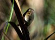
Mercer County bird surveying
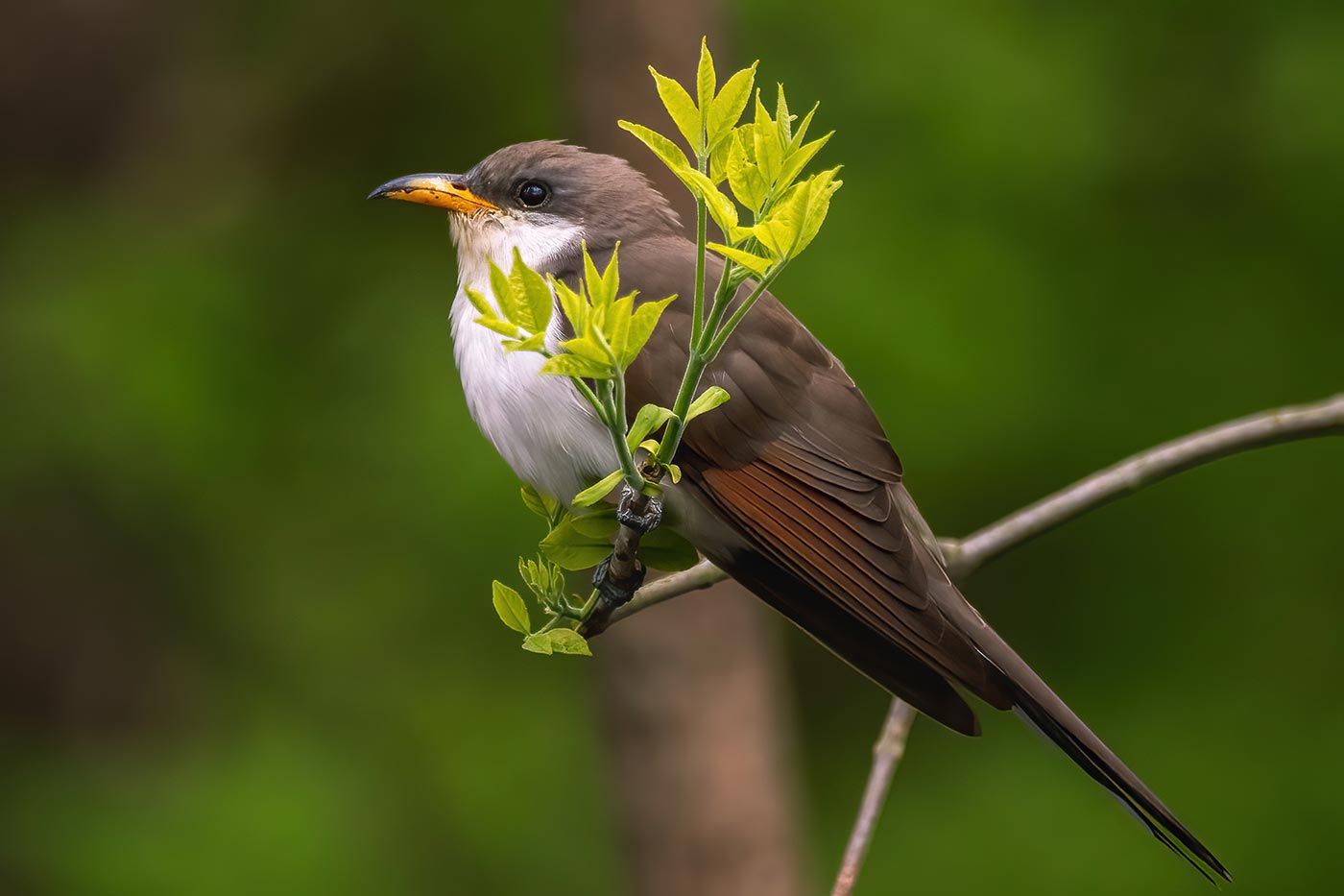
Just like that, we were officially surveying. As the designated Observer, I kept messy notes at each stop of the birds I saw and heard while James kept the time and checked the map for our next stop. We set into a groove early on, but when we paused for bagels out of the bed of the truck about ten stops in, we realized we needed to pick up the pace to get the route done in the allotted time. After a moment of waiting in the parking area at Pinnacle Rock State Park for a passing rain shower, our urgency picked up even more. This route had many hand-written notes about the stop descriptions, and we made a wrong turn more than once. Regardless, we found each of the stops eventually, and except for one area where construction removed a pull-off for a stop (and habitat), things ultimately went smoothly. Along the way, we totaled about 60 species, with Yellow-billed Cuckoos, Indigo Buntings, Red-eyed Vireos, and American Crows being some of the most common birds we saw and heard.

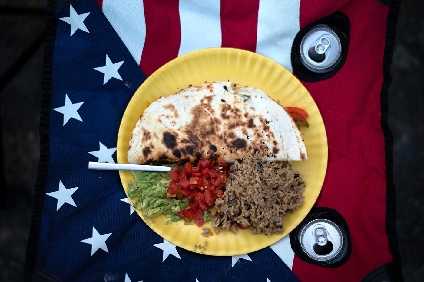
Caught in a Cookoff
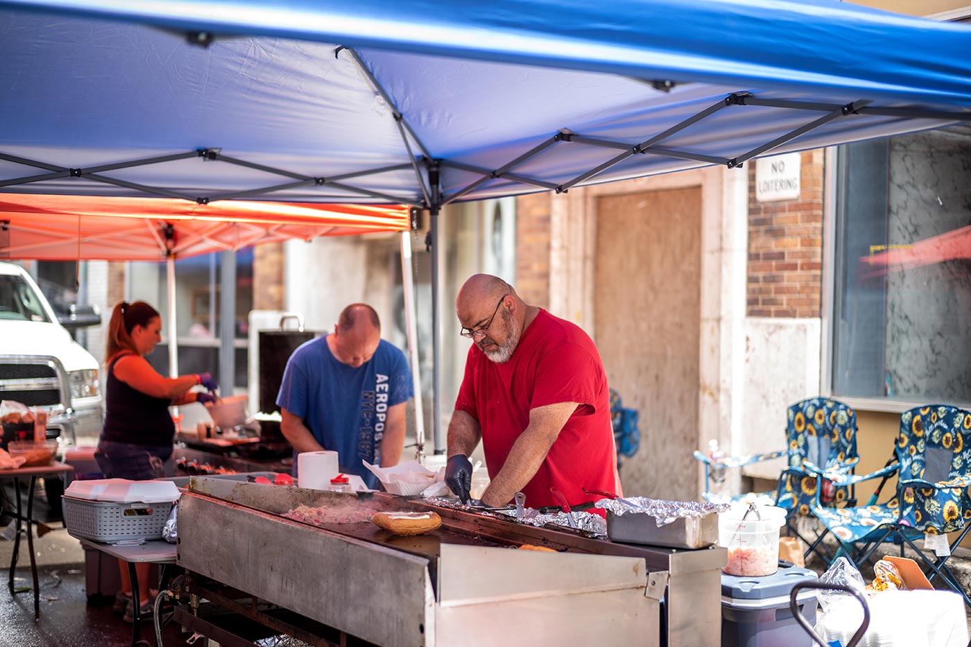
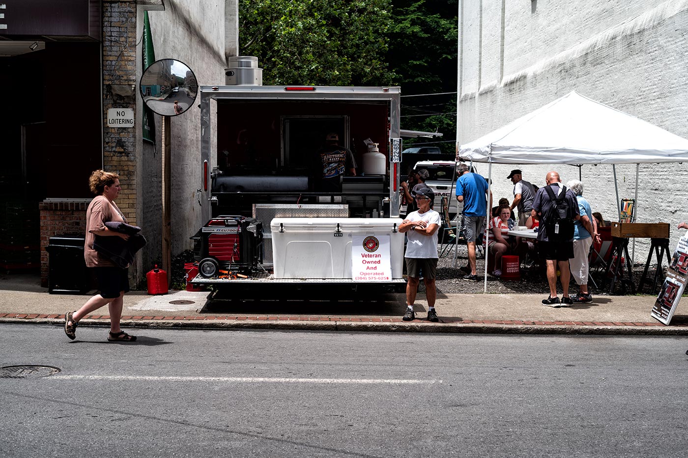
By the time we finished the route, we were ready for a break and some lunch. We decided to drive to Welch, where the next day’s survey would begin, and find a spot to pull our fire pit out to make lunch. After we crossed into McDowell County and rounded the turn into Welch’s main street, our jaws dropped as we stumbled into a crowded, blocked-off street filled with tents, trailers, and lots of people. The town of 3,000 people had exploded into a festival that we couldn’t resist checking out.
We found ourselves driving into the middle of the first inaugural WV Coalfields Cookoff, where dozens of amateur and professional BBQ teams were competing for state titles. Our lunch plans quickly went to the wayside, and we stopped in the Little General to get some cash and find some good food. We didn’t stay too long, but the detour was a fun addition to our weekend.

Panther State Forest and Wildlife Management Area
With bellies full, we had plenty of time left in the day to explore the area, and James suggested we drive over to Panther State Forest/WMA, which he remembered from a trip last year as being a state-park like area. We wandered through the country roads until we entered the managed area, which did not disappoint — Panther Creek was a gorgeous, abundant lake that meandered along the road, with dozens of pull-offs, campsites, and pavilions. It reminded me of Holly River State Park with summer deciduous forest scenes all around. As we passed birthday celebrations and potlucks, we were amazed by how many groups of people were taking advantage of the area’s many amenities. We chose a grassy area along the creek to park and relax for a while, with the sounds of the rushing water just beside the Jeep. Besides an unlucky black snake that got rattled by a single passing car (pun intended, but the snake was fine), it was a sweet few moments of tranquility.
Tug Fork Wildlife Management Area
If Panther were closer to Welch, we would have camped there, but we wanted to be as close as possible for our early morning start time. Instead, we noticed on our maps that public roads wound into Tug Fork Wildlife Management Area at a few points near Welch. We took a gamble in checking them out and found a great spot inside the WMA but on county road where we could park and pop open the tent. We made supper and spent several hours reading, talking, cooking, and listening to birds until the night had fully arrived, and headed to bed.

McDowell County bird surveying
We woke up early the next morning and listened to fledgling and adult Barred Owls as we made our coffee. We were prompt in our departure and determined to get through our second Breeding Bird Survey route faster than the one we did before. For this route, the coordinates were available as a .kml file, and finding the points was a breeze. The birding was more fun, too, with lots more activity and diversity overall than on the Mercer County route, plus more convenient stops and much less car traffic. Hooded Warblers, Yellow-billed Cuckoos, Red-eyed Vireos, Gray Catbirds, and Indigo Buntings were all over, and we breezed through the route.

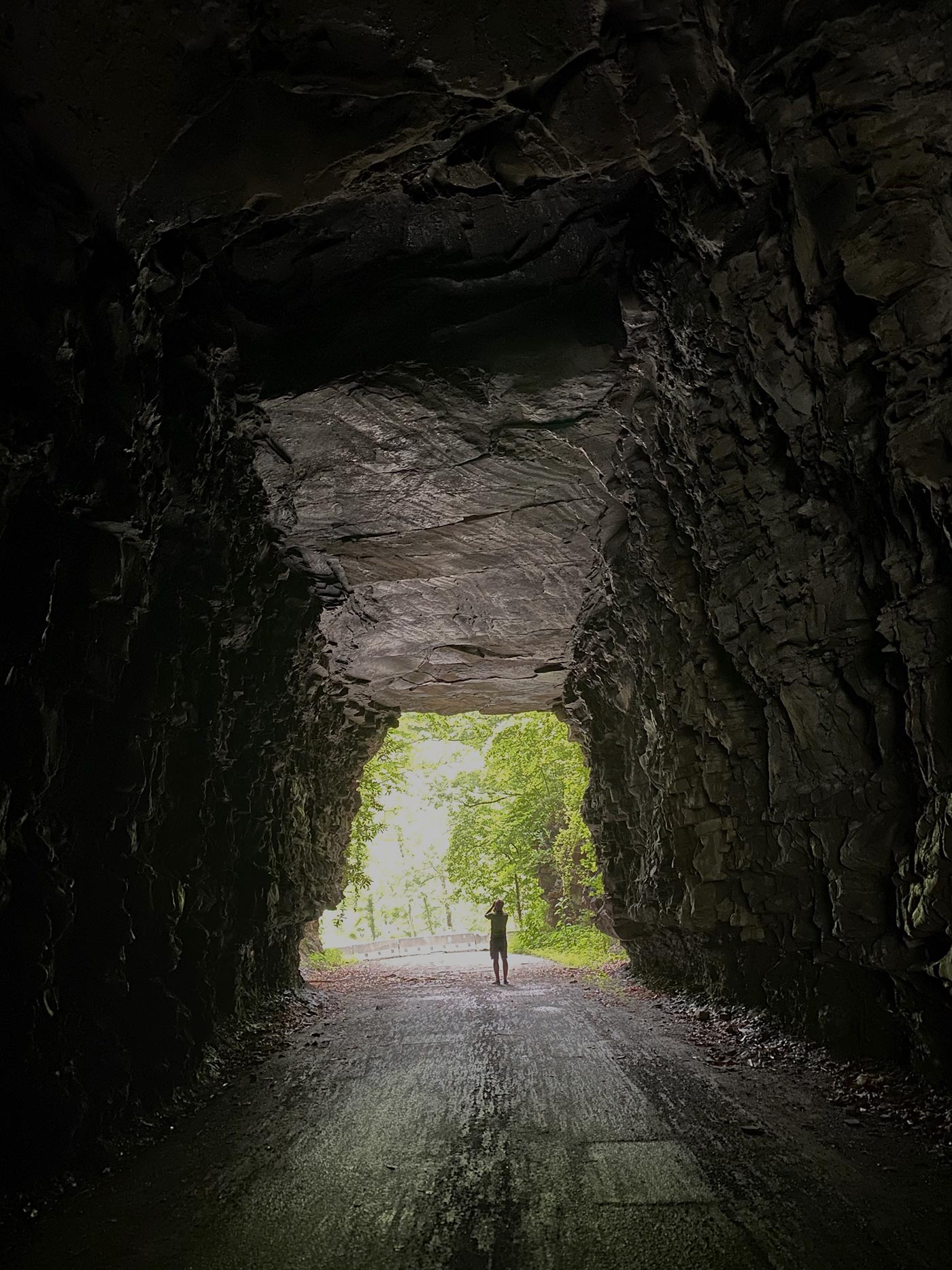
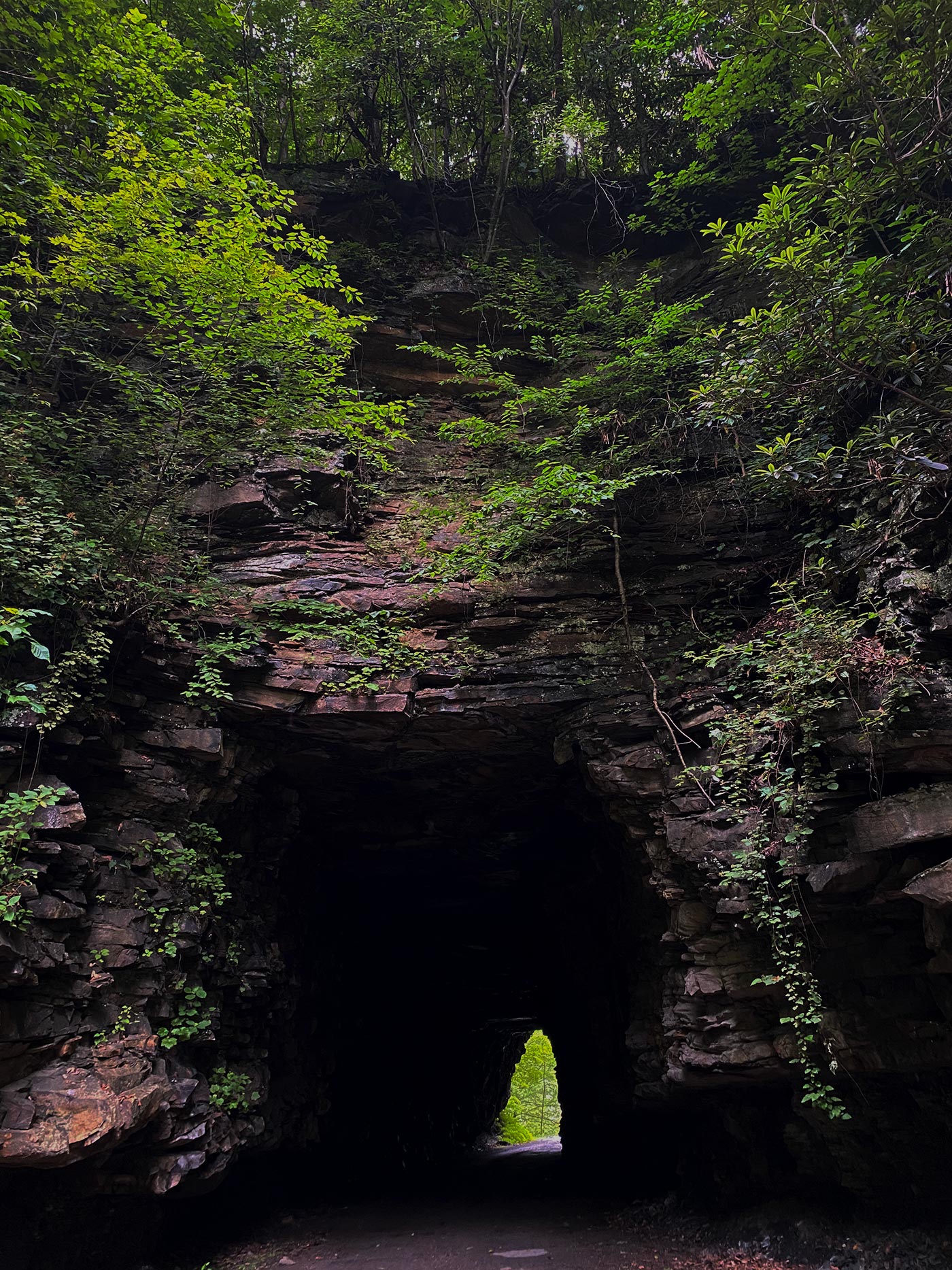
Davy Tunnel
We took a quick break, however, for a tunnel that had appeared as an attraction from one of my earlier Google searches of the area — the Davy Tunnel in Twin Branch. We spent just a few minutes checking out the closed-off section of the road to walk through the short, rough-cut tunnel with twisted vines and greenery appearing to be crawling into it. Here’s a short anecdote that I stumbled across in searching for information about this tunnel online. At any rate, it was a cool spot — we probably should have taken better photos there.

Gravel-roadside picnic
But we pressed onward and through 30, 40, and finally our 50th and last stop for the breeding bird surveys. It was a beautiful day, and we weren’t quite ready to head home, so we again consulted our maps and found a cool road to ramble down. As with most of the other places we had been through in the area, we weren’t alone – a few ATVs passed by here and there. The steady flow of off-roaders all weekend was a contrast to the roads we often drive closer to Morgantown, where we very rarely see another human, vehicle, or ATV. We ended up stopping at a large pull-off within sight of a cemetery to make our last meal in the fire pit. We took our time and laid in the grass while our “cowboy campfire breakfast” cooked.
Driving topless
Eventually, we had to make our way north toward home. We popped the top off the Jeep and headed in a longer route that took us through Mingo and Logan counties on the way back. We had one last surprise — a quick stop to check out R.D. Bailey Lake, managed by the US Army Corps of Engineers. We decided to check it out after passing a sign for it and were totally amazed to find a gorgeous, newly-constructed visitor center overlooking a perfectly picturesque lake and mountain view. There wasn’t direct access to the lake from the center, since it sat so high on the hillside above the water, and the building was closed, but still, woah, what a sight! It’s an overlook that is certainly worth checking out if you’re ever passing through.
Those breeding bird survey routes are likely not ones we’ll repeat, but we loved the chance to get to explore a corner of WV that we rarely see. But who knows… between the Jeep, birds, and our restless desire to venture, we never know where we’ll end up next.
Gallery