At a Glance
- Official road names: 45/1
-
Distance: 2.3 miles
-
Difficulty ratings: 2
-
Nearest towns: Morgantown
-
Nearby attractions: Little Indian Creek WMA, Downtown Morgantown, Short Story Brewing
Downloads
Overview
Rediscovering a Familiar Place
Little Indian Creek WMA is a great place just south of Morgantown. Mollee and I have spent a lot of time there birding, and it’s an easy place close by to get out and walk around. Little did I know that there are great trails in the area as well. The first time I visited, I drove past the main entrance and saw a gate in the distance, and turned around. I always thought a gate blocked the road going through the WMA and the only access was to a home. That’s why I have my trusty Avenza maps. They showed a county road should go all the way through.

A Muddy Playground
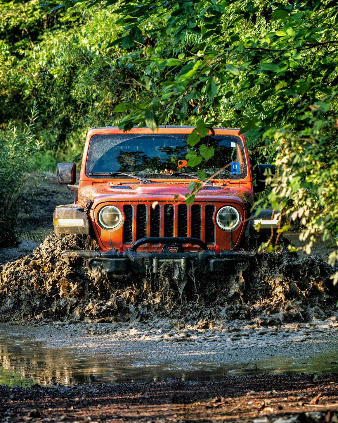
As you start down the trail, it’s a very typical West Virginia back road, rocky and full of puddles. As you wind down, a series of ponds appear through the trees, and you come to a large water hole. It may be deeper than the average person is comfortable driving, but the bottom is solid enough. As you come through, an opening will be on the right for a beautiful view.
Roughly half a mile farther, there’s another path the heads off to the right. There is a small wood bridge of questionable structural integrity. It seems solid enough in some spots, but I have yet to decide if I’m willing to drive over it. More investigation will be needed before I risk that. Moving on, you’ll come to the first of my two favorite spots along the trail.
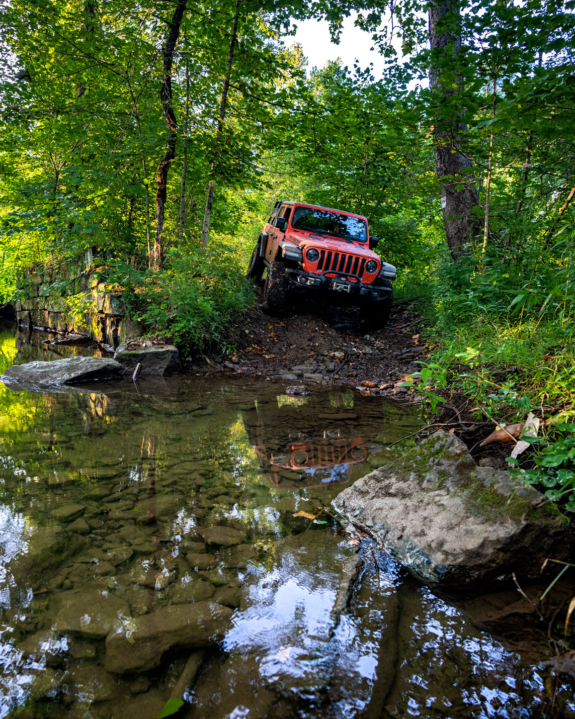
There’s a beautiful creek crossing. The Gladiator did just fine, but a vehicle with a long wheelbase, stock tires, and no lift could get hung up. Bring some Chaco’s or high, waterproof boots to walk up and down the creek. It’s tranquil, and you never know what wildlife you might discover.
Always Take the Side Route
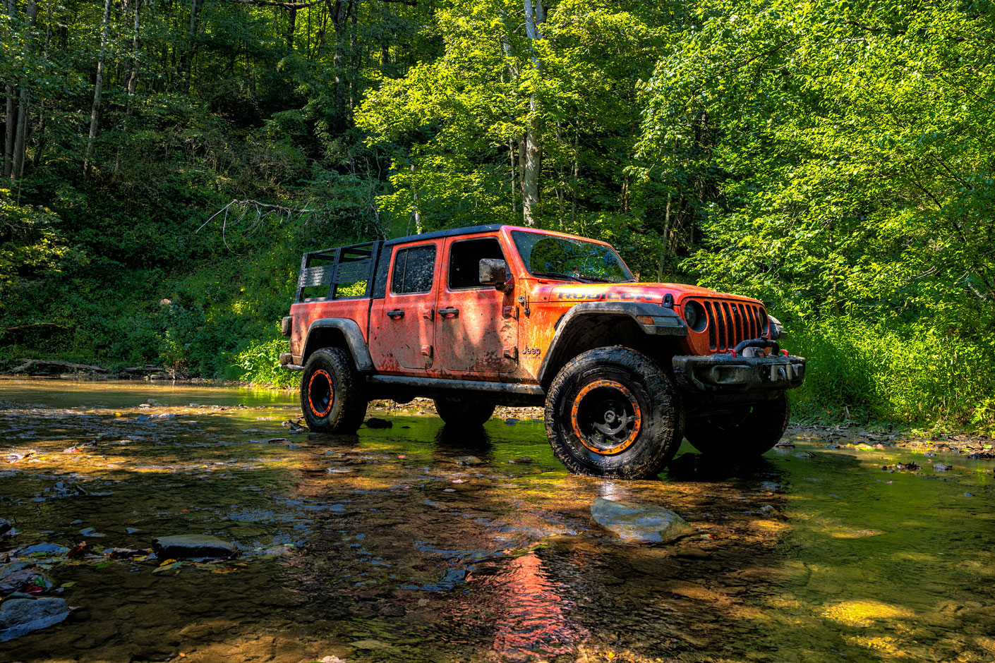
As you work your way through slippery mud pits and tight routes through the trees, keep left for a short out and back detour. You’ll cross the stream again and come to a small “island.” It seems like locals use this spot to drive their ATVs up and down the creek. It’s a bit more open and provides a great place to stop and relax. Bring a picnic or explore the stream more. These spots are amongst my favorite in West Virginia.
There’s a small loop that goes around this area with two deceivingly deep pits. The first was easy enough to escape from, but the second had us near the tipping point. Make sure you have recovery gear before attempting. When you’re ready to move on, you can go back the way you came or, if you’re feeling more adventurous, continue up the stream, and you have a few access trails back to the main course.
Back In the Trenches
From here on out, you’re mostly going to be in and out of mud holes. The first you come to has a fallen tree that provides a very tight path, but it is passable. You may get some pinstripes, though. With the density of trees, it’s always wise to have a saw if you get to a blocked point. As you work through the various mud holes, some look a little tricky. However, I found all of them to be relatively solid.
Just as you begin to despair, all of the puddles start looking the same, and you think you’ve entered a neverending loop; you’ll reach the crest and start your descent to the main road. A right will quickly bring you back to Highway 19, and you can continue to the next adventure.

Gallery